The Moody's insurance solutions blog
Get expert perspectives as our team weighs in on the latest events, topics, and insights to help you demystify risk and deepen resilience.


Snaefellsnes Peninsula, Iceland
Tag: USGS
Filter by:
USGS 2023 National Seismic Hazard Model Update: ...

The U.S. Geological Survey (USGS) has recently released an updated version of its U.S. National Seismic Hazard Model (NSHM) for 50 U.S. States…
USGS 2023 National Seismic Hazard Model Project ...
It was a privilege that the U.S. Geological Survey (USGS) selected Moody’s RMS headquarters in Newark, California, to host their public…
2018 USGS Hazard Map Updates: Is RMS Revising th...

In March 2018, RMS hosted the U.S. Geological Survey (USGS) workshop at our Newark headquarters in California to discuss the interim updates…

MyShake: New App Unveiled for California Earthqu...

As my colleague Mohsen Rahnama reminded us in his recent blog, the last destructive earthquake to strike Northern California was on October 17…
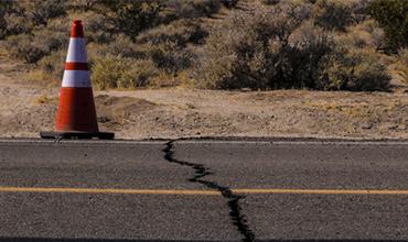
The Mw7.1 – 2019 Ridgecrest (California) Earthqu...

The recent events that shook a relatively remote part of the Mojave Desert region of Eastern California provide an acute reminder of the major…

Earthquakes and Tall Buildings: Any Changes for ...

A recent article entitled “A Seismic Change in Predicting How Earthquakes Will Shake Tall Buildings” that appeared in the New York Times on…
