Usage of the term ‘atmospheric river’ used to be the preserve of meteorologists, but now most Californians are aware of it.
Atmospheric rivers are (or used to be) joyfully nicknamed the ‘Pineapple Express,’ a regular phenomenon for the state where very moist air from the Hawaiian Islands some 2,000 miles (3,218 kilometers) away flows eastward through the atmosphere in long narrow channels.
With these channels between 250 and 375 miles wide on average, they transport vast amounts of water in the form of vapor, more water than any of the mightiest rivers.
Atmospheric rivers are often powered by low-pressure systems that generate higher wind speeds, allowing the transported water vapor to gain momentum. As the water vapor reaches the land, it cools and turns to precipitation, which eventually falls on California as heavy rain or snow.
Several atmospheric rivers make landfall each winter, producing valuable snowpack on the Sierra Nevada mountains and making a welcome contribution to the state’s water levels.
But when combined with an extratropical windstorm, together with stronger winds, the windstorm acts as a pump for the atmospheric river to accelerate the moisture flow, to deliver extreme rainfall.
With extreme rainfall, rather than recharging water tables and reservoirs, much of the runoff flows to the ocean or floodplains, meaning it does not always relieve flood conditions.
Two Atmospheric Rivers in One Week
Since the start of 2024, California has experienced some extreme weather events. Perhaps the most notable were three atmospheric rivers on the U.S. and Canadian West Coast, of which two rolled into California in the space of a week in late January and early February.
A smaller atmospheric river system swept into Northern California on January 30 and moved down the coast past San Francisco, but it was the second system, categorized as an ‘AR3’ event on the Atmospheric River Scale that caused major problems.
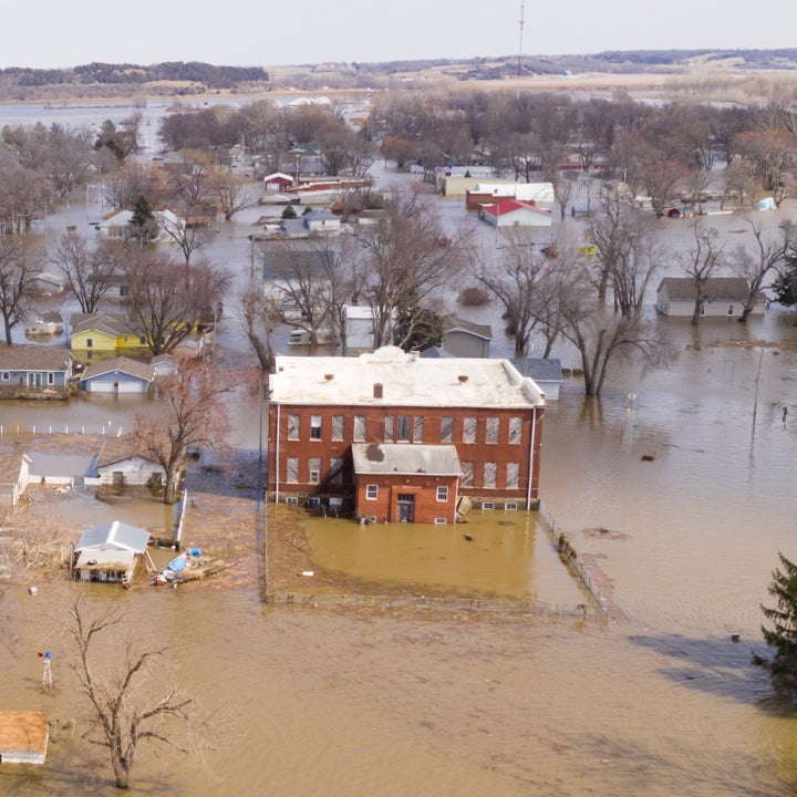
This second system rolled into Southern California on February 4, resulting in wind damage, heavy rainfall, mudslides, debris flows, and flooding in California.
A state of emergency was put in place in 10 counties, with hundreds of reports of flooding and landslides across California. Fallen trees and powerlines caused injuries, road blockages, and power outages, and over 900,000 customers lost power in California. Nine fatalities were reported.
A peak wind gust of 138 miles per hour (222 kilometers per hour) was recorded at Ward Peak, near Lake Tahoe, Placer County.
Widespread disruption was reported from San Francisco to San Diego, but it was Los Angeles County that was greatly impacted. On February 4, the National Weather Service (NWS) reported that downtown Los Angeles had received 4.1 inches (104 millimeters) of rainfall, the city's third-highest total for February since 1877.
Drainage systems became overwhelmed as approximately eight million gallons (30 million liters) of raw sewage spilled into the 15-mile-long Dominguez Channel in Los Angeles due to capacity issues, leading to the closure of multiple beaches.
On February 5, a weather station at the University of California, Los Angeles (UCLA) recorded a 24-hour rainfall total of 12 inches (300 millimeters).
Los Angeles County reported 520 mudslides and debris flows with a total of 84 buildings requiring damage assessment. One thousand firefighters responded to more than 400 debris and mud flows, 130 reports of flooding, and at least 50 rescues of motorists trapped in vehicles.
Moving into mid-February the flow of weather systems from the Pacific became relentless, with an atmospheric river bringing high winds and severe rainfall, with supercell storms causing tornado-like conditions and hail. The heaviest precipitation occurred in the western Transverse Ranges, with more than 10 inches in some locations.
By late February/early March, a monster blizzard blasted California’s Sierra Nevada with gusts of up to 190 miles (305 kilometers) per hour and dumped more than 10 feet of snow over the weekend, shattering the state’s “snow drought” and significantly boosting vital snowpack levels.
As the storms subsided, by mid-March, a consequence of all this precipitation was the extraordinary coverage of wildflowers – in California’s Death Valley.
Making Comparisons
How do these precipitation events compare to the norm, and to previous incidents, such as the atmospheric rivers in January 2023? Have these latest events been made more extreme due to climate change?
Looking at the early February events, rainfall records were certainly broken, such as in Los Angeles County which according to the NWS received more than 11 inches of rainfall in less than 72 hours.
These are totals equivalent to the rainfall these areas receive over multiple months. When looking at historical averages, the average Los Angeles County rainfall in February is 3.68 inches.
Last year’s atmospheric river events in December 2022/January 2023 were more widespread, with emergency declarations in 41 of 58 California counties, and the state receiving an average of nine inches of rainfall during this period.
Many areas received a year’s rain. Landslides and mudslides were more widespread, as land impacted by wildfires became particularly vulnerable.
While these latest atmospheric rivers caused flash floods in numerous California counties, Moody’s RMS estimated that economic and insured flood losses were not expected to surpass that of the series of atmospheric events that occurred in 2023.
The degree to which climatic change plays a role in these events is complex to explicitly quantify but there is growing evidence that climate change is contributing to the increase in frequency and intensity of storms and the risk of severe flooding in general.
This is largely due to the combined effects of the atmosphere’s increased ability to hold moisture in a warmer climate, as factors including sea surface temperatures, which between August 2023 and January 2024, reached an unprecedented average of 21.1 degrees Celsius, global temperatures reaching 1.52 degrees Celsius for the period from February 2023 to January 2024, plus El Nino, could all contribute.
Getting Prepared for Flood Events
With a wet season that is becoming punctuated by more severe rainfall events, like many regions in the U.S. and around the globe, California is playing catchup in terms of flood awareness, management, and prevention.
Today, nowhere is safe from flooding, even communities far from rivers and the coast face increasing flood risk given the unconfined nature of rainfall events.
Efforts have not been helped in the state, as there has been a trend of increased development in areas prone to floods amid stormwater infrastructure that was not designed to cope with such extreme rainfall events.
With historical rainfall records being regularly toppled, history is proving not to be a good predictor of the future. To capture such inherent complexity, Moody’s RMS U.S. Inland Flood Models deploy a stochastic catalog of 50,000 years to simulate more than one million possible flood events.
This breadth of simulation allows for a comprehensive understanding of the potential risks and damages associated with different types of storms, and through increased understanding, both insurers, homeowners, and stakeholders can realistically price – and mitigate – the growing issue of excessive rainfall events.
Event Loss Insights
The impact of severe rainfall in mid-February on insured flood losses for both the National Flood Insurance Program (NFIP) and private flood insurance is unlikely to be significant, given the low flood insurance penetration in California.
It is a concerning reality that many communities and homeowners who are exposed to flood risk do not have adequate insurance coverage, as less than two percent of homeowners in California have flood insurance through the National Flood Insurance Program (NFIP) despite the growing exposure to flood risk.
This is particularly problematic as floods can cause significant damage to properties, resulting in financial burdens that can be difficult to recover from.
Claims arising from such events are not only related to direct property damage from floods but can also stem from widespread power outages, damage to infrastructure, lifelines, and business disruptions.
The magnitude of business interruption and additional living expense claims is typically likely to be proportional to the spatial extent of the infrastructure disruption and the duration of the downtime.
Another important loss element is the financial implications from the hundreds of landslides, particularly because they are not typically covered under standard homeowners' insurance policies.
When a landslide occurs, homeowners may find themselves facing significant out-of-pocket expenses to repair damage to their property, rebuild structures, or even relocate, in case their home becomes uninhabitable. These costs can quickly escalate, potentially leading to financial hardship.
There are upsides, however, as the California Department of Water Resources (DWR) reported that by February 20, enough rain had fallen to supply 1.6 million households for a year, with drought largely alleviated since late 2022, but with a downside that the intensity of atmospheric river rainfall events generates landslides and severe floods.
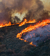
In terms of what the rainfall and snow mean for the California wildfire season remains to be seen, as experts question whether saturated ground and snow cover means a slower start to the wildfire season, and if the rainfall will result in rapid plant growth – potentially fueling wildfires later in the season if there is a prolonged dry spell.
As always, look out for updates from our Event Response Services team for the latest.