In preparation for the upcoming 2024 renewals in Japan and New Zealand, Moody’s RMS is committed to helping our customers benefit from our high-definition (HD) models, which facilitate more complete views of risk resulting in more confidence in transparent risk-based transactions. As leading brokers and reinsurers adopt this approach, it is our priority to partner with the entire (re)insurance market to enable all companies to take advantage of HD quality modeling.
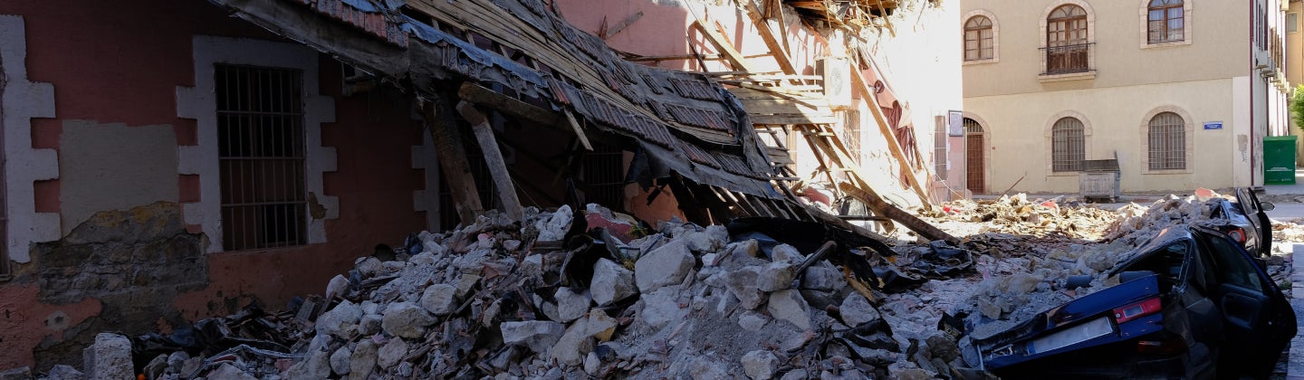
Earthquake risk, unlike climate risk, is tail-driven. This means that standard Monte Carlo methods are inappropriate for simulating infrequent damaging earthquake events. To address this, the Moody’s RMS HD earthquake models use a weighted simulation so that the full range of severe but rare events are captured efficiently. As a result, the standard output for Moody’s RMS HD earthquake models is not simply a uniform Year Loss Table (YLT) or Period Loss Table (PLT) but weighted to account for this infrequency of the most severe loss events. The weighted loss tables require special use. In this webinar, you’ll learn best practices for using and grouping the HD earthquake loss outputs.
Moody’s RMS offers HD models across both earthquake and climate perils in Japan and in New Zealand. In 2023, Moody’s RMS released an update to the New Zealand Earthquake and Tsunami HD Model representing the latest view of seismic risk in the region. Firms can group the latest view of New Zealand earthquake risk with the only view of flood risk available to the market via the New Zealand Flood HD Model. With the Japan Earthquake and Tsunami HD Model and the Japan Typhoon and Flood HD Model, firms can unlock a complete understanding of natural catastrophe risk across these perils, calibrating their business strategy towards profitable and resilient growth.
In this webinar you’ll:
- Gain a more complete understanding of HD Earthquake results: Earthquake event sampling, the weighted PLT framework, and grouping Earthquake and Climate results.
- Learn about best practices for risk transfer when working with HD results.
- Review grouping analytics using the Japan Earthquake and Tsunami HD Model and the Japan Typhoon and Flood HD Model in a case study.
Finally, you will increase your skill and confidence when working with HD output during the Q&A session with Moody’s RMS experts.
Speakers
Chesley Williams
Senior Director, Product Management
Chesley Williams
Senior Director, Product Management
Chesley manages the commercial development of the RMS earthquake and tsunami models for the Asia-Pacific region. Chesley joined the Model Development Group at RMS in 1995, with expertise in developing seismic source models.
Through her tenure at RMS, Chesley was a model developer for key products including the 2018 RMS Japan Earthquake and Tsunami HD model and earthquake models for Europe, Asia, and Latin America. Chesley has recently shifted roles from model development to product management to use her years of experience at RMS to facilitate strategic product development, product marketing and product management.
Chesley holds a master's degree in geophysics from Stanford University, where she researched ground deformation associated with the 1989 Loma Prieta earthquake.
Ashley Bernero
Director, Product Management, Moody's RMS
Ashley Bernero
Director, Product Management, Moody's RMS
Ashley Bernero is a Senior Product Manager on the Applications Product Management team. She is responsible for Risk Modeler, the model execution application within the Moody's RMS Risk Intelligence Platform, with a focus on the integration of high-definition simulation models as well as model customization with Model Composer. She has been at Moody’s RMS for nearly a decade and held many roles, including client support and earthquake model product management.
Ashley holds a bachelor’s degree in industrial engineering from Pennsylvania State University and a master’s degree in civil engineering from Stevens Institute of Technology.
Margaret Joseph
Sr. Product Manager, Moody's RMS
Margaret Joseph
Sr. Product Manager, Moody's RMS
As a member of the Model Product Management team at Moody’s RMS Margaret works on our tropical cyclone models for the Asia-Pacific region, most recently and predominantly our latest Japan Typhoon Model. At Moody's RMS she has worked in the catastrophe response team for significant global natural catastrophe events through 2010 to 2013.
Margaret holds a MSc in Remote Sensing from University College London and a BSc in Geography from the University of Southampton. Margaret is a member of the (U.K.) Remote Sensing and Photogrammetry Society, a fellow of the Royal Geographical Society, and through the latter is a Chartered Geographer.