When looking at the historical record of catastrophe losses across the Caribbean region, even over the last few decades, it is hurricane events that have dominated the insured losses.
From Hurricane Sandy in 2012, Irma and Maria in 2017, and Dorian in 2019, the islands of the Caribbean, which range from Bermuda and the Bahamas in the north, from Cuba in the west, through to Trinidad, Tobago, and Aruba in the southeast off the Venezuelan coast, regularly bare the brunt of tropical storms and hurricanes tracking west from the Atlantic.
Using the latest, updated view of hurricane risk for the Caribbean is therefore vital for insurers, and Moody’s RMS issued an updated view in the RiskLink® Version 23 release last year.
While hurricanes are expected to continue to dominate the cat risk for the region, insurers also understand that earthquakes are an important contributor for specific islands such as Hispaniola (Haiti and the Dominican Republic) and even a driver of cat risk for Trinidad and Tobago.
At return periods starting around 100 years, earthquakes show more than a 20 percent contribution to the risk.
Even in the last 15 years, the region has seen two events greater than Mw7; both events in Haiti – a Mw7.0 in 2010, and a Mw7.2 event just three years ago in 2021. Puerto Rico experienced a Mw6.4 event in 2020.
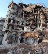
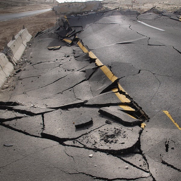
While earthquakes are lower-frequency events, they can have very severe consequences. The 2010 Haiti earthquake stands out as a global tragedy and more than 100,000 fatalities, and over a quarter of a million structures destroyed. Earthquakes need to be considered in any cat risk analysis for the Caribbean.
Drivers of Caribbean Earthquake Risk
With more than thirty countries and territories across the region, from the largest – Cuba with nearly 110,000 square kilometers (42,470 square miles), to Sint Maarten covering 34 square kilometers (13 square miles), three nations with populations over 10 million, and economic disparities from higher GDP per capita countries such as Puerto Rico and The Bahamas in contrast with low GDP in Haiti, the Caribbean is a diverse region.
Building codes, construction styles, age of building stock, and exposure values vary – sometimes depending on the history of the country and its past influences.
Caribbean countries are also at different stages of development and economic status, some focus on specific industries such as tourism, finance, or agriculture.
Resilience efforts may also focus more on hurricane risk, and enhancing construction from wind and water, rather than seismic resilience.
Earthquake hazard in the Caribbean itself is driven primarily by subduction zone-related events under the Lesser Antilles – the arc of islands that extend east of Puerto Rico; and then by crustal faults within the Greater Antilles – the larger islands from Cuba to Puerto Rico and in particular Hispaniola; and in Trinidad and Tobago, off the coast of Venezuela.
Latest View of Caribbean Earthquake Risk
We are delighted to announce the release of Moody’s RMS Caribbean Earthquake Model, available now on Risk Modeler™, an application on the Intelligent Risk Platform, and also in the RiskLink Version 24 release for on-premise model users.
This release gives (re)insurers in the region an updated view of the earthquake risk to complement Moody’s RMS latest perspective, and additionally, we have released an industry exposure database for earthquakes for the first time in the Caribbean.
This gives (re)insurers new perspectives as using our latest models and industry exposures, model users can better understand the relative risk posed by these two major perils across the region.
Providing the market with the most up-to-date view of earthquake risk across the Caribbean, the Version 24 Caribbean Earthquake Model release now expands coverage to include Cuba, the Bahamas, Aruba, Bonaire, Curacao, and Bermuda.
The model update represents a substantial enhancement of the understanding of seismic risk to the region by incorporating advancements in earthquake science and accounting for our latest assessment of building performance during earthquakes, including:
- Hazard module incorporates the latest earthquake science for the definition of the stochastic event set (location, magnitudes, and rates) as well as for ground motion footprints and site amplification quantification.
- Vulnerability functions calibrated to incorporate the latest building practices to better quantify and differentiate seismic building performance.
- Detailed island-specific building surveys were used to define the insured inventory database of primary building characteristics.
With the model update, the subduction zone sources such as the Lesser Antilles subduction zone where the oceanic crust of the South American Plate is being subducted under the Caribbean Plate, have been completely redefined in terms of maximum magnitudes, geometry, and event rates.
The fault catalog included in the model has been greatly expanded to reflect the latest understanding of the hazard posed by crustal faults across the region.
In addition, the stochastic events set has also been expanded considering an earthquake catalog from the year 1502 through to 2022, together with the expanded geographic coverage, to better reflect the full suite of potential earthquakes that could occur across the Caribbean.
The characterization of ground motion footprints has been greatly enhanced within the updated Caribbean earthquake model, applying a spectral acceleration-based ground motion model approach based on the latest science and latest models.
Ground motion observation data was used to determine the best-applicable suite of ground motion prediction equations (GMPEs) for the various tectonic regions across the Caribbean.
The latest science focused on site amplification is incorporated, which is dependent on Vs30 (time-averaged shear-wave velocity to 30-meter depth, reflecting local site conditions), spectral response, tectonic setting, and building height at a given location.
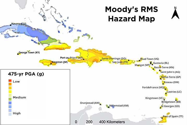
Using output from the new model, the figure below shows the latest Moody’s RMS perspective on the seismic hazard for the Caribbean, showing peak ground acceleration (PGA) on rock for a 475-year return period, and the contrasts in hazard across the region.
During the interval between model updates, there have been several enhancements to local building codes resulting in the model incorporating reassessed vulnerability design regions and new year of construction bands to reflect the latest building codes and building practices.
Accounting for the latest building practices and design requirements introduced by the various jurisdictions has resulted in the performance of structures in the region being completely reassessed to best represent how building, contents, and business interruption coverages will impacted by earthquakes in the Caribbean.
The new model was implemented using spectral response-based vulnerability curves, with the building inventory data fully redeveloped to reflect the current insured building stock and the unique variations seen from island to island.
Additional model implementation enhancements were added to align the Caribbean Earthquake Model with other Moody’s RMS models including the differentiation of performance across more distinct building height bands and reassessed business interruption modeling accounting for more distinctions by occupancy.
Post-event loss amplification modeling has been added to the updated model to account for claims inflation, demand surge, and super catastrophe effects. Lastly, the model now includes a Builder Risk solution along with a full reassessment of the specialty models for industrial facilities and marine cargo.
The updated Caribbean Earthquake model provides clients with a robust, comprehensive representation of seismic risk, accounting for damage due to ground shaking and ground deformation associated with liquefaction and landslides.
To learn more about the new Caribbean Earthquake Model, clients can access the “Scope and Rationale” documentation available on the Moody’s RMS Support Center.