During an average September, New York City (NYC) gets 4.3 inches (110 millimeters) of rain for the entire month.
In just a few hours during the morning of September 29, some parts of the city received almost eight inches (200 millimeters) of rainfall.
According to The Weather Channel, this late September rain resulted in September 2023 ranking as the fourth-wettest month in NYC history, behind August 2011, September 1882, and October 2005.
It was a stalled area of low pressure off the Atlantic coast that brought in excessive rain, with totals on September 29 varying across the Tri-State Area.
Valley Stream in Long Island topped nine inches of rainfall (228 millimeters), with 8.5 inches (215 millimeters) at John F. Kennedy (JFK) Airport, 7.3 inches (185 millimeters) in Brooklyn, and nearly six inches (152 millimeters) of rainfall at Central Park in the heart of Manhattan.
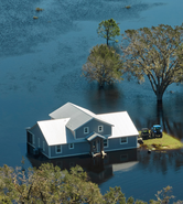
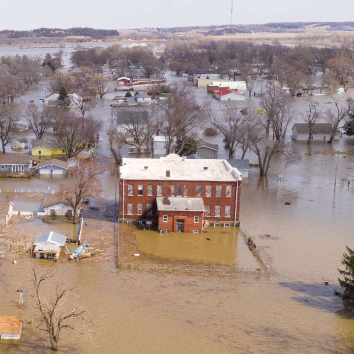
The mayor of New York and the Governors of both New York and New Jersey issued State of Emergency declarations, advising citizens across the Tri-State Area to stay in place or to move to higher ground if needed, warning of life-threatening flooding.
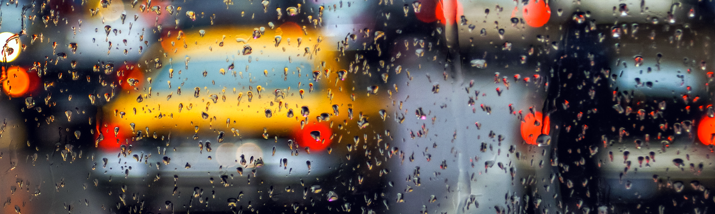
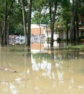
Residents and drivers on Brooklyn’s streets battled through waist-deep waves of water; highways were closed, and many stations across the NYC Subway were closed as they became inundated with flood water.
Residents in at least six NYC basement apartments became trapped, hospital patients were transferred away from flood zones, and more than 150 schools experienced flooding.
Terminal A at La Guardia airport was closed due to the flood, 300 flights were canceled and 500 were delayed across La Guardia and JFK.
Two Years Since Excessive Rainfall from Hurricane Ida
Memories of tragedy returned as it was just over two years ago on September 1, 2021, since the remnants of Hurricane Ida dumped six inches (152 millimeters) of rain in a matter of hours over the Tri-State area.
Rainfall intensity in September 2021 far exceeded this current event. At Central Park in Manhattan, 3.15 inches (80 millimeters) of rain fell in just an hour during the Ida event, compared to a maximum one-hour recorded rainfall of around two inches this time.
In 2021, the rainfall caused extensive disruption and claimed the lives of 43 people, with many trapped in basement apartments.
The day after the floods, New York Governor Kathy Hochul warned the heavy downpour which led to flash flooding in New York City is now the ‘new normal’ because of the effects of climate change and is pushing the limits of existing urban infrastructure.
The city’s commissioner of the Department of Environmental Protection, Rohit Aggarwala, said in a press conference, “The sad reality is our climate is changing faster than our infrastructure can respond.”
Stormwater Drainage Struggles to Cope
Like many major cities, NYC has an aging stormwater drainage system including over 7,500 miles (12,070 kilometers) of sewers, and these recent rainfall intensities far exceed the design capacity for the NYC stormwater system of around 1.75 inches per hour (44 millimeters per hour).
The standard stormwater design criterion in NYC is based on a five-year return period storm that in turn is based on historical data from 1903 to 1951.
Extensive urban development and impervious surfaces have also reduced the city's natural ability to absorb rainfall, with approximately 72 percent of New York City's surface being impervious, heightening the flash flood risk due to quicker rainfall runoff.
About 60 percent of NYC has a combined sewer system, where a single pipe carries both stormwater runoff and sewage from buildings.
When these systems are overwhelmed, untreated sewage can enter local waterways and even the basements of homes and businesses, causing significant health and environmental risks.
The scenes of flooded streets, subways, and basements underscore the challenges posed by aging infrastructure that was not designed to handle such extreme weather events.
The Flood Insurance Gap and Urbanization
These more regular severe floods are also not moving the needle regarding the inland flood insurance protection gap, where a significant gap exists in inland areas of NYC.
Residents get a false sense of security if they base their flood insurance purchase decisions on outdated FEMA flood maps from 2007, resulting in residents living in impacted residential inland areas having single-digit flood insurance penetration rates.
We discuss this protection gap in a separate blog.
It is becoming clear that the existing FEMA flood maps mean that New York City’s effective Flood Insurance Rate Maps (FIRMs) are not reflective of the current risk.
More than ten years after Superstorm Sandy in 2012, these outdated FIRMs continue to guide the requirement to purchase flood insurance with a mortgage from a federally regulated lender, which is putting exposure at risk where it is known to be vulnerable to flooding.
Preliminary FIRMs from 2015 are being used to guide New York City’s building code and floodproofing, except where the effective FIRMs are more restrictive, causing a source of considerable confusion for homeowners.
There are still existing properties devastated by Sandy that continue to have no flood insurance, while new or rebuilt neighboring homes are required to follow building codes based on the 2015 preliminary FIRMs appealed by the city.
Increasing Exposure
Waterfront developments are also steadily increasing, with a 2022 study by the NYC comptroller reporting that the market rate value of real estate within the 100-year flood zone has increased to over US$176 billion, representing a 44 percent increase since Sandy.
The study also suggests that rising tides and more frequent storms will put exposure upward of US$242 billion (in current market value) at risk of coastal flooding by the 2050s, a 38 percent increase in value from today.
The NYC Panel on Climate Change (NPCC) projects that by the end of the century, the city could experience as much as 25 percent more annual rainfall than today, and one and a half times as many days with more than one inch of rain.
Managing excess water presents a complex challenge that requires cities like New York to invest significantly in both underground and surface water management. This involves striking a balance between preserving existing infrastructure and adopting innovative approaches.
Additionally, predictive models play a vital role in addressing the impact of climate change on urban infrastructure.
These advanced modeling techniques enable informed decision-making by simulating various forward-looking scenarios, guiding drainage system upgrades, assessing compound coastal and inland flood risks, and enhancing disaster preparedness.
With the potential of excessive rainfall events increasing in frequency and severity – supercharged by climate change, it is important that mitigation measures are introduced for sewer infrastructure, and the sewerage system is updated to reflect the changes in the risk landscape, exposure, and significant population increase even for sewers built just a few decades ago.
Cities need to set short- and long-term goals based on sound modeling to guide both infrastructure planning and development, and to inform residents of the risks they face, to help build resilience and increase flood insurance penetration.