Michael Kozar, senior modeler – Model Development, RMS
Hurricane Nate continues to race towards the central Gulf Coast today. The hurricane has become significantly better organized in the last several hours, and now has maximum sustained winds in excess of 90 miles per hour (144 kilometers per hour) based on the RMS HWind snapshot at 18:00 UTC today. This surface wind analysis is based upon data collected from the National Oceanic and Atmospheric Administration and U.S. Air Force Reserve Hurricane Hunters in addition to some surface and satellite-based observations.
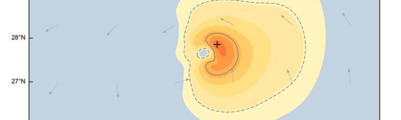
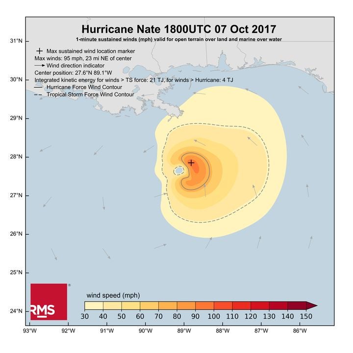
Figure 1: Hurricane Nate RMS HWind Snapshot – 1 minute maximum sustained winds Sat 7 Oct 18:00 UTC
It is immediately apparent from the HWind snapshot that Nate is a highly asymmetric storm. The storm is moving quite quickly, and as a result the right side of the storm is much stronger than the left side. On the right side of the storm, the winds from Nate’s counterclockwise circulation are moving in approximately the same direction as the storm’s translational speed, whereas on the left side, Nate’s quick forward motion is opposing the storm’s circulation.
Ultimately, as shown in the HWind snapshot image, all of Nate’s hurricane force winds, and the vast majority of its tropical storm force winds are located to the right of center. As a result, the worst hazards from this system should be expected to the east of where the storm makes landfall, especially since these stronger winds will be coming in an onshore direction. Given the current forecast guidance, this suggests Biloxi, Gulfport, and Mobile will likely face stronger winds than will New Orleans or Baton Rouge.
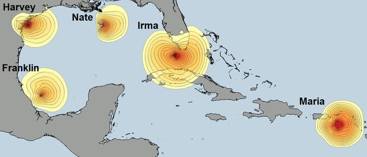
Figure 2: Plot of 1-minute sustained wind fields comparing Nate to other storms from the 2017 hurricane season using our HWind snapshot products. The wind field contours begin at 30 mph and increment in 5 mph bands until 110 mph
In terms of storm size, Nate is not an overly large storm. The asymmetric wind field of Nate contains an estimated 21 Terajoules (TJ) of integrated kinetic energy. This is somewhat comparable to the nearly 30 TJ of integrated kinetic energy that was present in Hurricane Harvey, but of course Harvey was more intense than Nate and was moving more slowly so the risks were somewhat different.
Hurricane Franklin in early August of this year might be the better comparison, as it had a similar intensity and storm size to Nate. On the other hand, storms like Maria and Irma were both more intense and much larger than Nate and thus had substantially more integrated kinetic energy. Prior to striking Puerto Rico, Maria at one point had more than four times the amount of integrated kinetic energy as Nate does now. Irma was even larger prior to striking Florida, with about 100 TJ of integrated kinetic energy.
Share:
You May Also Like
October 06, 2017
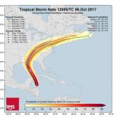
Tropical Storm Nate: Latest HWind Track Probability Analysis
Michael is a senior modeler on the RMS HWind team based at the Tallahassee, FL office. Michael has a bachelor's and a master's degree in Meteorology from Penn State University and a PhD in Meteorology from Florida State University. He has experience forecasting and analyzing tropical cyclone wind fields and has also studied interannual hurricane variability in the North Atlantic.