2023 Catastrophe Review Report
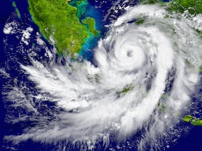
2023 was the world’s warmest year on record, 1.35℃ above pre-industrial (1850-1900) levels. The exceptionally high temperatures intensified the impact of weather-related disasters, particularly severe convective storms, wildfires, and floods.
Against a backdrop of escalating natural disasters and increasingly interconnected risks, the 2023 Catastrophe Review Report reveals a year marked by the rise of secondary perils.

In 2023 Moody's...
Reported on
140+ eventsDeveloped accumulation footprints for
43 eventsDelivered modeling information for
14 eventsIssued
8 Industry Loss EstimatesMajor Events of 2023
Click on the left navigation to learn more.
-
Hurricanes & Typhoons
-
Hurricane Idalia
-
Hurricane Otis
-
-
Convective Storm
-
U.S. Severe Convective Storms
-
-
Wildfires
-
Hawaii Wildfires
-
Canada Wildfires
-
-
Earthquake
-
The Kahramanmaraş Sequence
-
-
Windstorm
-
Storm Ciarán
-
-
Flood
-
United States
-
Italy (Emilia-Romagna Region)
-
Hong Kong
-
New Zealand
-

Hurricane Idalia
Florida Landfall: August 30, 2023
Landfall Intensity: Category 3
Peak Wind Gust: 88.5 mph (142.2 km/hr)
Moody's RMS Insured Loss Estimate: US$3 – US$5 billion
Best Estimate: US$3.5 billion

Hurricane Idalia
While considerably less impactful than astorm like Hurricane Ian the prior year, Hurricane Idalia was the event thatdefined the 2023 North Atlantic hurricane season, at least from a U.S.standpoint. This is mostly because Idalia was the only landfalling U.S.hurricane. Still, the storm was complex in its own right, with several uniqueevent characteristics, drivers of damage, and open questions that will taketime to come into full clarity. Idalia brought destructive hurricane-forcewinds and a catastrophic storm surge to much of northwestern Florida, but itsstrongest winds were limited to a small area near landfall in a sparselypopulated section of the Florida coastline.
Like Ian, Idalia was a complex, three-peril(wind, storm surge, and inland flooding) event that came amidhigher-than-average inflation, new and unproven legislation, and a somewhatuncertain state of the Florida insurance market, but Idalia is expected to havea considerably smaller impact on overall (re)insurance market dynamics thanIan. In terms of total industry insured losses, Ian was one of the costliesthurricanes to ever hit the U.S., with loss impacts affecting all marketsegments: insurance through to reinsurance and capital markets. Conversely,Idalia is expected to be well within company reserves, and primarily anearnings event for the insurance segment (despite the effects of a hardeningreinsurance market, underscored by higher attachment points and more retentionfor carriers), with minimal impacts on reinsurers.
Moody's RMS estimates insured losses fromHurricane Idalia in the U.S. to be between US$3 and US$5 billion, with a bestestimate of US$3.5 billion. Moody's RMS also estimates losses to the NationalFlood Insurance Program (NFIP) to be around US$500 million from storm surge andinland flooding in the event.
Hurricane Otis
Landfall: October 25, 2023
Landfall Intensity: Category 5
Moody's RMS Insured Loss Estimate: US$2.5 to US$4.5 billion
Hurricane Otis
In the 24 hours leading up to landfall, Otis underwent an unexpected period of rapid intensification, something that was not initially forecast by the hurricane or global deterministic forecast models, as it took advantage of the conducive environmental conditions, which consisted of light to moderate vertical shear and sea surface temperatures of 29 to 30°C. According to NHC intermediary advisories, Otis intensified from a tropical storm to a Category 5 major hurricane in the 12 hours between 15:00 UTC on October 23 and 03:00 UTC on October 24, a rate three times the criteria to be classified as rapid intensification.
Otis made landfall as a Category 5 major hurricane near Acapulco in Guerrero state on October 25. It was the first Category 5 major hurricane to make landfall on the west coast of Mexico since recordkeeping began. Observational wind speed data, while limited, suggested a broad swath of exposure and population was affected by major hurricane-level wind gusts. The strongest winds from the event caused damage to a large stretch of modern, high-rise exposure along Acapulco Bay, including apartment complexes, hotels, and resorts. Aerial imagery and remote reconnaissance showed Otis caused some of the most incredible wind damage to modern-day high-rise structures ever seen. Recovery efforts are expected to take months, if not longer. Moody’s RMS estimates US$2.5 to US$4.5 billion in private market insured losses from Major Hurricane Otis.
Tropical Storm Hilary
Date: August 20-21
Amount of Rainfall: 1 to 4 inches in Los Angeles, over 3 inches in Palm Springs in 24 hours
Impact: Nearly 50,000 power outages
Tropical Storm Hilary (TBD)
While considerably less impactful than astorm like Hurricane Ian the prior year, Hurricane Idalia was the event thatdefined the 2023 North Atlantic hurricane season, at least from a U.S.standpoint. This is mostly because Idalia was the only landfalling U.S.hurricane. Still, the storm was complex in its own right, with several uniqueevent characteristics, drivers of damage, and open questions that will taketime to come into full clarity. Idalia brought destructive hurricane-forcewinds and a catastrophic storm surge to much of northwestern Florida, but itsstrongest winds were limited to a small area near landfall in a sparselypopulated section of the Florida coastline.
Like Ian, Idalia was a complex, three-peril(wind, storm surge, and inland flooding) event that came amidhigher-than-average inflation, new and unproven legislation, and a somewhatuncertain state of the Florida insurance market, but Idalia is expected to havea considerably smaller impact on overall (re)insurance market dynamics thanIan. In terms of total industry insured losses, Ian was one of the costliesthurricanes to ever hit the U.S., with loss impacts affecting all marketsegments: insurance through to reinsurance and capital markets. Conversely,Idalia is expected to be well within company reserves, and primarily anearnings event for the insurance segment (despite the effects of a hardeningreinsurance market, underscored by higher attachment points and more retentionfor carriers), with minimal impacts on reinsurers.
Moody's RMS estimates insured losses fromHurricane Idalia in the U.S. to be between US$3 and US$5 billion, with a bestestimate of US$3.5 billion. Moody's RMS also estimates losses to the NationalFlood Insurance Program (NFIP) to be around US$500 million from storm surge andinland flooding in the event.
U.S. Severe Convective Storms
Total Insured Losses: Over US$52 billion
Average Loss per Event: Exceeded US$1 billion
Largest Loss Event: Around US$4.4 billion
Tornado Activity: 378 confirmed tornadoes in the first quarter
U.S. Severe Convective Storms
In 2023, severe convective storm losses broke records in the U.S. – even without an EF-5 rated tornado, a large-scale tornado outbreak, or a multistate large-scale derecho event to drive industry losses. The year had a multitude of severe convective storm events that, when aggregated together, produced overall losses exceeding US$52 billion.
Interestingly, no individual event losses exceeded US$5 billion. Average losses per event for 2023 exceeded US$1 billion and were almost 40 percent higher than the 2017–22 average – but not nearly as high as the 2011 recordsetting US$1.8 billion average per event. Unlike 2011 and 2020 with individual events that produced losses above US$10 billion (inflation and exposure adjusted), 2023’s largest loss event was far below that amount and totaled around US$4.4 billion, which made the year unique. With 18 events, 2023 produced the fourth-largest number of severe convective storm events that surpassed US$1 billion in losses in modern history, exceeding 2020’s 14 events.
Severe convective storm activity in 2023 showed a continued trend of moving from the traditionally active area of the Great Plains states eastward into the Mississippi and Tennessee Valleys. Figure 5 depicts the regional contribution of severe convective storm activity annually between 2010 and 2023. Using SPC local storm report data through November, the Dixie Alley region (which includes parts of Louisiana, Mississippi, Alabama, Tennessee, and Georgia) experienced a very active year in terms of severe thunderstorm events. This was largely driven by the multistate outbreaks that occurred in March and April.
Storm Ciarán
Date: November 1-2, 2023
Affected Regions: Northern France, the Channel Islands, Belgium, and southern UK
Meteorological Characteristics: Explosive cyclogenesis, strong wind gusts, heavy rainfall, and a tornado in Jersey
Impact: Over 1.2 million power outages in France, significant damage in UK and Channel Islands
Fatalities: 8
Moody’s RMS Insured Loss Estimate: US$1 – US$1.6 billion (90% losses in France)
Storm Ciarán
Between November 1 and 2, 2023, a rapidly deepening area of low pressure, named Storm Ciarán by the U.K. Met Office and also known as Storm Emir in parts of Europe, tracked across northwestern Europe and brought strong wind gusts to several countries. Ciarán caused widespread damage and disruption. Northern France, the Channel Islands, Belgium, and the southern U.K. were the worst affected.
The center of Ciarán crossed southwestern and southern England on November 1 and overnight into November 2, andit produced new November minimum pressure records in both England and Wales: 953.3 hPa in Plymouth, England, and 958.5 hPa in St. Athan, Wales. The previous record in England (959.7 hPa) had stood for more than 100 years. Ciarán was an exceptionally severe storm for the time of year. It brought significant winds to areas along its southern flank, most notably to parts of northern France and the Channel Islands. Ciarán also produced heavy rainfall across southern parts of the U.K., northern France, and the Channel Islands. The latter was affected by some bands of intense and exceptionally squally rain, very large hail, strong winds, and lightning. One of these bands also produced a tornado that tracked for 5 mi (8 km) across eastern parts of Jersey.
The most severely impacted areas were in the northern regions of France, including Brittany, Normandy, and Hauts de France, as well as the Channel Islands. Moody’s RMS estimates an industry loss for Windstorm Ciarán ranging from US$1.0 to US$1.6 billion (€0.9 to €1.5 billion) for Europe, with 90 percent of the losses in France.
Hawaii Wildfires
Date: August 8-11, 2023
Area Affected: Approx. 6,721 acres (2,720 hectares)
Structures Damaged or Destroyed: Over 2,700
Fatalities: 99
Moody’s RMS Economic Loss Estimate: US$4 – US$6 billion
Hawaii Wildfires
Hawaii experienced its worst natural disaster in state history in 2023 after a rapid ignition of wildfires caused the damage or destruction of over 2,700 structures, predominantly in the historic town of Lahaina on western Maui. Significant damage was inflicted on the Lahaina Historic District including the Pioneer Inn, Waoila Church, Old Lahaina Courthouse, and multiple museums – all at great loss for Maui’s community and cultural heritage. The event sadly claimed the lives of 99 people, making it the fifth-deadliest wildfire in U.S. history, and the deadliest since 1918. Many more people were displaced, sheltered, or evacuated. A significant number of properties in Lahaina were located in or near the wildland-urban interface (WUI), a transition zone between wilderness and human-developed land.
In the lead-up to the event, more than 80 percent of the state was in drought conditions, and about 16 percent experienced severe drought. The fires were caused by an unusual set of circumstances: Hurricane Dora was passing well south of the Hawaiian Islands and a strong area of high pressure was stationed to the north of the islands. These combined to result in a strong north-south pressure gradient across the central Pacific that drove a strong easterly low-level winds toward Hawaii that accelerated down the west side of the West Maui Mountains and created localized wind gusts that exacerbated the fires.
Recovery and reconstruction in Lahaina is projected to last years, mirroring the aftermath of recent destructive wildfires on the mainland. The devastation has also dealt a significant blow to tourism-related income. Moody’s RMS estimates US$4 to US$6 billion in economic losses from the Lahaina conflagration and Kula wildfires.
Canada Wildfires
Season Duration: April through October 2023
Area Burned: Over 45.7 million acres (18.5 million hectares) across Canada
Number of Fires: Over 6,500 fires
Structures Damaged or Destroyed: More than 600
Canada Wildfires
Canada experienced a record-breaking wildfire season in 2023. More than 45.7 million acres (18.5 million hectares) of land were burned from Nova Scotia in the east to British Columbia in the west. The burned area was more than 6.5 times the average area burned over the preceding 10 years (2013–22). Over 1,000 more fires occurred in 2023 than in an average year, for a total of over 6,500 fires. While most occurred in remote areas, fires prompted widespread evacuations and impacted more than 600 structures, which surpassed the 1989, 1995, and 2014 fire seasons.
Air-quality issues made international headlines as smoke plumes from Canada drifted across the northern and northeastern U.S., resulting in air-quality alerts in New York, Connecticut, Minnesota, Michigan, Wisconsin, and Delaware. New York City experienced some of the worst air quality in the world for several hours, which led to the cancellation of flights and outdoor events and prompted the U.S. National Weather Service to issue a rare dense smoke advisory.
The 2023 Canadian wildland fire season unfolded against the backdrop of a drought that originated in late summer 2022. Some areas experienced temporary relief from the drought during the 2022–23 winter, but drought conditions re-intensified in 2023. The meteorological dynamics leading to the 2023 season were characterized by a rapid transition from a triple-dip a Niña, which started in late 2020, to El Niño conditions. Comparisons with the late 1990s and early 2000s were made. This period was marked by a triple-dip La Niña between late 1998 and early 2001 and was followed by severe drought in western Canada.
The Kahramanmaraş, Turkey Earthquake Sequence
Date: February 6, 2023
Magnitude: Mw7.8 and Mw7.5
Affected Area: 42,471 mi2 (110,000 km2) in Turkey
Structures Damaged or Destroyed: Over 2.4 million units
The Kahramanmaraş, Turkey Earthquake Sequence
In February 2023, a devastating series of earthquakes impacted Turkey and northern Syria, marking a grim milestone as the deadliest seismic sequence in the region since 1999 and the largest event since 1939. The earthquakes left a trail of destruction with 2,433,365 detached units reported as damaged or destroyed. Many structures that initially withstood the earthquakes were later deemed damaged beyond repair, leading to immediate demolition.
The far-reaching collapse of structures, even those 186 mi (300 km) away from the rupture site, pointed to the significant role of ground motion amplification coupled with local site effects, including substandard construction practices. Despite the introduction of regulations and building codes, there was significant concern over subpar construction standards in Turkey. Some of the buildings that collapsed in the Kahramanmaraş events were constructed within the last year, revealing the lack of adherence to safety standards as the Turkish provisions were rarely enforced in the affected areas. An additional consideration for Turkey is how the country approaches its existing and future building stock.
The earthquakes were complex from both seismological and engineering perspectives. However, while devastating, the earthquake sequence generated a wealth of data that continues to unfold and will do so for some time. This evolution of data makes estimating the insured loss from such events a challenge. In the weeks following the earthquakes, Moody’s RMS released an insured loss estimate of US$5 billion (based on exchange rates at the time of the events), a view that has been supported by others in the market as time has passed. Almost a year later, the losses continue to evolve.
California Flooding (San Francisco)
Date: early January 2023
Amount of Rainfall: 10.38 inches over 10 days
Moody’s RMS Economic Loss Estimate: US$5 – US$7 billion
Moody’s RMS Insured Loss Estimate: US$0.5 – US$1.5 billion (including losses to NFIP)
Tropical Storm Hilary
Date: August 20-21
Amount of Rainfall: 1 to 4 inches in Los Angeles, over 3 inches in Palm Springs in 24 hours
Impact: Nearly 50,000 power outages
South Florida Flooding (Fort Lauderdale)
Date: April 12-13
Amount of Rainfall: 20 inches (500 mm) in 12 hours
Structures Damaged or Destroyed: 1,353
US Floods
A series of extratropical cyclones impacted California over three weeks in early January and resulted in heavy rainfall, mudslides, debris flows, and heavy snow at high altitudes. An even-rarer occurrence was the flooding in California associated when the remnants of Hurricane Hilary in August.
In Fort Lauderdale, Florida in April, a stalled warm front brought torrential rainfall that caused localized flooding in Broward County, with some areas receiving record-breaking rainfall amounts. A major disaster was declared with 1,353 properties or structures were deemed to have been affected or sustained minor to major damage from the flooding, severe storms, and tornadoes.
Italy Flooding (Emilia-Romagna region)
Date: May 2-3 and May 15-17, 2023
Cause of Flooding: Severe rainfall following severe drought conditions
Fatalities: 15
Evacuations: 36,000
Best Estimate: US$3.5 billion
Italy Floods
Two separate severe rainfall events struck the Emilia-Romagna region of Italy in just two weeks in early May. An area of low pressure over central Italy produced localized thunderstorms and prolonged rainfall for around 36 hours on May 2 and 3. Then, between May 15 and 17, Storm Minerva remained broadly stationary in the Mediterranean Sea and produced prolonged and intense rainfall that fell onto already-saturated ground and led to widespread flash and river flooding, as well as hundreds of landslides across Emilia-Romagna and parts of Marche and Tuscany.
Fifteen people were killed, around 36,000 people were evacuated, and thousands of rescues were carried out by emergency services as the floodwaters inundated dozens of towns and villages across over 100 municipalities in the four eastern provinces of Ravenna, Forlì-Cesena, Bologna, and Rimini. Disruption was widespread. Ravenna Province sustained the greatest impact with at least 3,000 homes flooded, according to local media.
Hong Kong Flooding
Date: September 7-8, 2023
Cause of Flooding: Heavy rainfall associated with Typhoon Haikui
Amount of Rainfall: Record hourly rainfall of 6.2 inches on September 8
Hong Kong Floods
According to the Hong Kong Observatory, the heavy rain that impacted Hong Kong and southern China on September 7 and 8 was brought by the trough of low pressure associated with the remnants of Typhoon Haikui, which made landfall in Fuijan Province, China, on September 5. More records fell, and the Hong Kong Observatory recorded the highest hourly rainfall total in 140 years of 6.2 in (158.1 mm) on the afternoon of September 8.
Subsequent flooding led to widespread transport disruption across Hong Kong, with roads and subway stations inundated with floodwater. Several shopping malls, schools, and businesses were flooded; the most significant flooding was reported in Wong Tai Sin District.
New Zealand Flooding
Date: January 27-29, 2023
Cause of Flooding: Heavy rainfall
Amount of Rainfall: Auckland Airport received 10.1 inches on January 27
Structures Damaged or Destroyed: Auckland Airport received 10.1 inches on January 27
Over 30,000 properties and 8,000 motor vehicles
New Zealand Floods
In late January, New Zealand was left counting the cost of significant flooding after record-breaking rainfall struck the country’s North Island over the weekend celebrating Auckland Anniversary Day. Damage and disruption were reported across North Island including Auckland, the Coromandel Peninsula, Pukekohe, and the Bay of Plenty. New Zealand received little respite as the remnants of Severe Tropical Cyclone Gabrielle in February paved the way for extensive flooding, after what was described as one of the worst storms to hit New Zealand in living history brought significant rainfall and flooding. New Zealand is no stranger to floods. While significant loss events have occurred in the past, large population centers had previously been spared. The floods of 2023 highlighted the materiality of flood risk in the country.
Italy Hail
Date: July 18-25, 2023
Record-Breaking Hail: 7.5 inches in Friuli Venezia Giulia
Insured Losses: Expected to exceed US$2 billion
Impact: Damage to vehicles, and a Boeing 767 aircraft
Italy Hail
In July 2023, Italy experienced a series of severe convective storms that were particularly intense and affected the same region several times in a row. The hail events that impacted northern Italy’s Po Valley were clustered in a short period, from July 18 to 25.
On July 19, a hailstone measuring a staggering 6.3 in (16 cm) was reported in Carmignano di Brenta township in the Italian region of Veneto. This broke the record for the largest hailstone observed in Europe. However, the record did not hold for long. Just five days later, on July 24, an even larger hailstone that measured 7.5 in (19 cm) was found in Azzano Decimo in the Italian region of Friuli Venezia Giulia, surpassing the record from a few days earlier. On this day, a series of factors perfectly aligned to produce favorable conditions for the formation of supercell storms.
The ensuing insured losses are unprecedented. The final loss figure has yet to emerge, but it is clear that insured losses will be well above US$2.2 billion (€2 billion), even despite the relatively low insurance-penetration rate. Several factors contributed to such high losses. The series of events was characterized by high hazard intensities. Also, events affected densely populated areas with high concentrations of commercial and industrial exposure.
2023 Tropical Cyclone Seasons
Select
- North Atlantic
- Western North Pacific
- Eastern North Pacific
- Australia Region and South Pacific
- Southwest and North Indian Oceans
North Atlantic
Fourth most-active season on record, after 2020 (30 storms), 2005 (28 storms), and 2021 (21 storms).
Despite the high number of named storms, in many ways the season was rather average.
While not as impactful or costly as 2021 with Ida or 2022 with Ian, 2023 will probably be best remembered for Hurricane Idalia.

Named Storms

Hurricanes

Major Hurricanes
Western North Pacific
The total of 16 storms was well below the long-term climatological average of 26 storms.
2023 had the fewest observed storms since 2010 (14 storms) and tied with 1998 for the second-fewest storms since recordkeeping began in 1951.
Named Storms

Typhoons
Storm (Dora) crossed the international dateline from the Central Pacific Basin
Eastern North Pacific
The year will be long remembered for the multiple impactful hurricanes on the western coast of Mexico, most notably Major Hurricane Otis.
A Category 5 major hurricane near Acapulco in Guerrero state on October 25. It was the first Category 5 major hurricane to make landfall on the west coast of Mexico since recordkeeping began.
Named Storms
Hurricanes
Major Hurricanes
Australia Region and South Pacific
Australia’s strongest landfalling cyclone in 8 years – Ilsa.
Below the long-term average of 11 storms, but unusually high proportion storms achieved extreme intensities.
3 Category 5 tropical cyclones: Darian, Herman, and Ilsa.
Named Storms

Category 5 Severe Tropical Cyclones
Southwest and North Indian Oceans
Freddy tracked across the Indian Ocean for more than 5 weeks to become the longest lasting and highest ACE-producing tropical cyclone on record.
90% of Sittwe, Myanmar was destroyed in Extremely Severe Cyclonic Storm Mocha.
Severe Cyclonic Storm Biparjoy caused widespread disruption to infrastructure across India’s western state of Gujarat.

North Indian Ocean cyclones

Southwest Indian Ocean cyclones