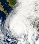
It seems somehow fitting that a storm underwent rapid intensification today, the peak of the North Atlantic hurricane season. Indeed, as forecast, Florence grew impressively from a tropical storm to a powerful Category 4 major hurricane — as of 1600 UTC on Monday, September 10, — with maximum sustained winds near 130 miles per hour (195 kilometers per hour), according to data from a recent National Oceanographic and Atmospheric Administration (NOAA) reconnaissance aircraft mission into the storm.
A ridge of high pressure is guiding Florence on a west-northwest to northwest path across the southeastern Atlantic Ocean between Bermuda and the Bahamas towards the southeastern U.S. Swells generated by Florence are already affecting Bermuda, with warnings of life-threatening surf and rip current conditions.
With each advisory, the chances of the storm missing the U.S. is rapidly narrowing. Most global models call for a landfall over the Carolinas as a major hurricane. Although the latest National Hurricane Center (NHC) “cone of uncertainty” includes the possibility of landfall between South Carolina and southern Virginia, there has been a strong, consistent guidance that a landfall over North Carolina is the most likely scenario. RMS HWind now shows that the two cities with the highest probability of greatest impact are both in North Carolina: Jacksonville and Wilmington.
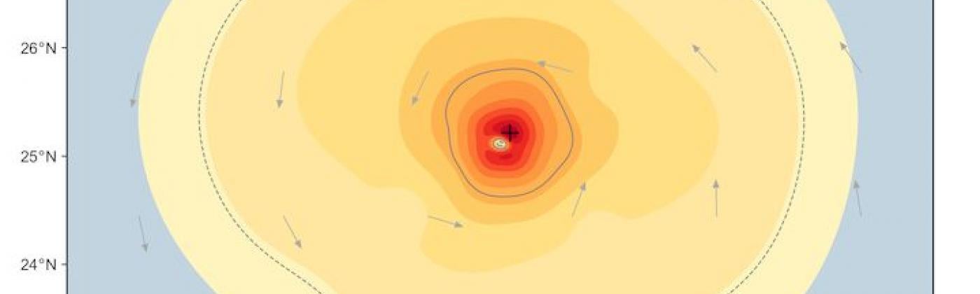
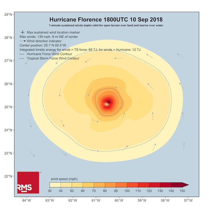
RMS HWind snapshot of Hurricane Florence at 1800 UTC, September 10, 2018
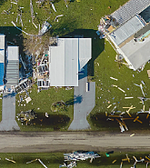
As is the case with these developing events, the details, such as the precise landfall location and intensity, remain somewhat uncertain and will be dependent on the storm’s behavior between now and landfall on Thursday. What is becoming clear is that there is an increasing risk of significant, widespread impacts from Florence over the southeastern U.S. from damaging hurricane-force winds, coastal storm surge, and inland flooding. Interests in the mid-Atlantic region should monitor the progress of Florence very closely and heed the warnings and advice of local emergency management officials.
Rainfall After a Potential Stall
A building high pressure ridge over the Ohio Valley area is expected to result in a gradual decrease in forward speed as Florence approaches the coastline of the southeastern U.S. later this week, with the potential to halt the storm’s forward progress. This could result in prolonged and exceptionally heavy rainfall over the Carolinas, which could lead to significant inland flooding. Current rainfall forecasts call for up to 10 to 20 inches of rain in some areas. Although some will point out that this range does not come close to the peak rainfall experienced last year in Harvey (60 inches), flooding from Florence could still be significant and the mountainous topography of inland North Carolina make it difficult to anticipate the worst affected areas.
Not Normally Northerly
These events that affect northern Florida and the Carolinas are infrequent, and since 1851, only ten major hurricanes have made a direct landfall between the 500-mile or so stretch of coast between Jacksonville, Florida, and Cape Hatteras, North Carolina. If forecasts verify, Florence would be the eleventh. Towards the northerly-end of this coastal area, there are only three hurricanes on record of at least Category 4 strength that have come within 100 miles of Wilmington, North Carolina — Hazel in 1954, Helene in 1958, and Diana in 1984.
The last Category 4 hurricane to strike the southeastern U.S. was Hugo in 1989, although Hugo went to South Carolina, rather than towards North Carolina as is currently forecast for Florence. Hurricane Fran was the last hurricane to strike the Carolinas, making landfall as a Category 3 event at Cape Fear, North Carolina, on the evening of September 5, 1996.
There has never been a Category 5 hurricane make landfall north of Florida. Judging by the latest satellite imagery and data retrieved from NOAA reconnaissance aircraft missions, Florence has a shot at attaining Category 5 intensity but it is easy to forget with all the media attention that it still has a long way to travel before impacting land.
As always, RMS will be releasing regular pre-landfall information and products to clients and RMS HWind will be releasing real-time wind footprint snapshots every three hours throughout the event, and please follow RMS on Twitter, LinkedIn and visit the RMS blog for updates.
Share:
You May Also Like
March 20, 2024
Moody’s RMS 2023 Catastrophe Review: Secondary Perils Headline Again
Based in London, James works as a Senior Modeler within the RMS Event Response team, supporting real-time event response operations and assisting on various event response projects. James holds a bachelor’s degree in Physical Geography and Geology from the University of Southampton and a master’s degree in Applied Meteorology from the University of Reading.