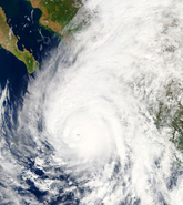
All eyes are on Hurricane Lane as it started to make its northerly turn towards the Hawaiian Islands late yesterday (Wednesday, August 22) and at the time of writing (Thursday, August 23, 1600 UTC) Lane is heading north, some 200 miles from the Hawaiian Islands as a Category 4 major hurricane with wind speeds of 130 miles per hour (209 kilometers per hour).
If Hurricane Lane did make landfall in the state, according to CNN it would become the first major cyclone to achieve this in 26 years, since Hurricane Iniki in 1992. Landfall does not look likely though; the current best-estimate wind field forecasts from the Central Pacific Hurricane Center (CPHC) as of 1000 UTC, Thursday August 23, show that hurricane force winds are not currently expected to impact land. But there is still an outside chance; due to Lane’s forecast track, a shift in the track direction and intensity could bring hurricane force winds onto land. Based on the current CPHC wind speed probability, there is a less than 20 percent chance of hurricane force winds impacting any of the islands in Hawaii.
Lane is forecast to gradually weaken in intensity in the coming days due to increased vertical wind shear, and Lane’s closest approach to the Island of Hawaii will be approximately 130 miles (200 kilometers) southwest of the southern tip of the Island of Hawaii at around 00:00 UTC on Friday August 24. At this point, Lane’s hurricane force winds are expected to extend around 28 miles (46 kilometers) from the center of the storm, which would not impact land.
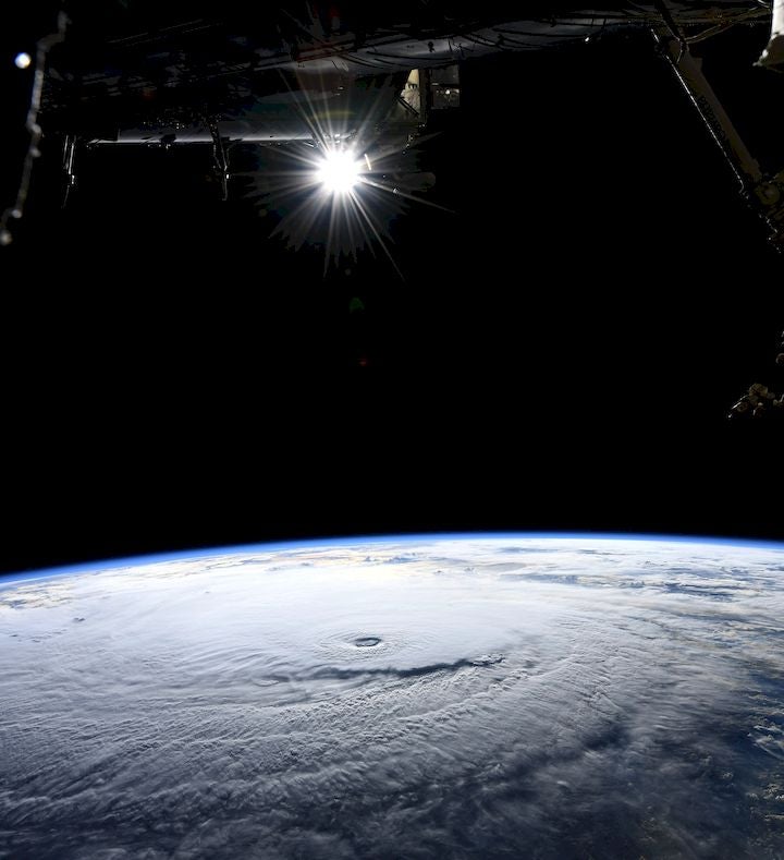
NASA astronaut Ricky Arnold photographed Hurricane Lane on Tuesday, August 21, during a flyover from the International Space Station. Image credit: NASA/Ricky Arnold
If the forecasts point to Hurricane Lane remaining offshore and bypassing Hawaii, this does not mean that Lane will pass without incident. In reality, the focus should not now be on the location or intensity of the storm, as dangerous weather is still expected to extend far beyond the center of the storm regardless of how close the eye gets to land. Tropical storm force winds are forecast to extend up to 126 miles (204 kilometers) and may impact the western extent of the Island of Hawaii.
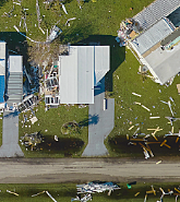
This system could bring damaging winds and flash flooding to all islands in Hawaii; winds could be accelerated over Hawaii’s elevated terrain and could be damaging to property and infrastructure. Preparations are well under way; officials have advised citizens to make sure they have enough supplies for up to two weeks, to outlast prolonged power outages and other potential emergencies. Buses are ferrying residents in need of shelter, and homeowners are preparing their properties as best as they can.
Rainfall will be significant as Lane is relatively slow moving, and recent CPHC advisories have warned of prolonged heavy rainfall which could result in flash flooding, landslides, and mudslides. Even with the center of the storm around 200 miles away, weather stations on the Big Island have already measured seven to twelve inches (170 to 300 milimeters) of rainfall in the past 12 hours, with the media already reporting landslides. According to the CPHC forecast, storm total rainfall accumulations could amount to more than 20 inches (500 millimeters), and they note that flooding could occur in areas not usually prone to flooding.
Although it looks as if the Hawaiian Islands will still be 26 years without a landfalling hurricane, the offshore threat from Lane through exceptional rainfall and tropical storm winds has the potential for significant disruption. RMS clients can get the latest information on Hurricane Lane from RMS OWL, and follow RMS on social media on Twitter, Facebook or LinkedIn.
Share:
You May Also Like
March 20, 2024
Moody’s RMS 2023 Catastrophe Review: Secondary Perils Headline Again
Based in London, James works as a Senior Modeler within the RMS Event Response team, supporting real-time event response operations and assisting on various event response projects. James holds a bachelor’s degree in Physical Geography and Geology from the University of Southampton and a master’s degree in Applied Meteorology from the University of Reading.